
The ocean is a vast area of tremendous mystery and beauty that makes up more than 70% of the surface of our planet. Scientists and explorers alike are still puzzled by the secrets that lie with questions like how deep the ocean really is. Indeed, the ocean’s depths are a tribute to the wonders of Earth’s geology and life, from the dazzling shallows to the unfathomable abyssal plains.
The average ocean depth is 12,080 feet (3680 meters), while the deepest point in the ocean measures 36,089 feet (11,000 meters) and is found in the Mariana Trench in the Pacific Ocean.
But if we are being precise – the oceans depth varies, depending on the different layers it is made up of. They consist of a mix of the deepest parts and lowest sea-level points on Earth.
Why Should We Care?
Understanding the significance of ocean depth extends beyond acquiring knowledge about the oceans themselves. It also encompasses the ability to anticipate and mitigate the various environmental consequences arising from changes in Earth’s environment. These insights are crucial for improving our response to earthquakes, tsunamis, and other natural hazards.
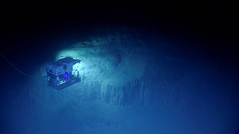
How Are Ocean Depth Measurements Taken?
Bathymetry is the study of the underwater landscape, including the depths and shapes of the ocean floor, riverbeds, streambeds, and lakebeds. Scientists utilize bathymetric data to investigate the impacts of climate change, such as beach erosion, sea level rise, and land subsidence.
Scientists and researchers can use different methods like Sonar, Radar, and Satellite methods to measure ocean depth. Sonar mapping uses sound waves to determine the sea floor’s contours.
Sonar Measurements
Sonar (Sound Navigation and Ranging) is the primary tool used for ocean depth measurement, especially in the form of multibeam and echo sounders.
This method involves emitting sound pulses directly towards the ocean floor. These pulses travel through the water, hit the seabed, and then bounce back to the surface where they are captured by the sonar system. The time it takes for the sound waves to return is recorded, and using the speed of sound in water, scientists can calculate the depth of the ocean at various points.
Multibeam sonar systems are particularly effective as they can cover a wide area by emitting multiple sound pulses at different angles simultaneously. This creates a detailed map of the seafloor’s topography, revealing features such as mountains, valleys, and trenches.
Radar Methods
While radar technology is often associated with atmospheric measurements, it’s not typically used for direct measurement of ocean depths due to the inability of radio waves to penetrate water effectively.
However, radar is crucial in hydrography for determining the water’s surface conditions and for short-range detection of surface objects. It can also assist in mapping shallow water bodies indirectly by providing surface elevation data, which, when combined with satellite altimetry, helps in inferring underwater topography near coastlines.
Radar altimeters on satellites measure the time it takes for a radar pulse to travel from the satellite to the sea surface and back, allowing for the calculation of sea surface height, which indirectly informs about underwater features when analyzed over time.
Satellite Measurements
Although satellite measurements have significantly improved our understanding of ocean depth compared to previous methods, they don’t directly measure the Earth’s seafloor. Instead, satellites analyze the sea surface and identify variations that correspond to underwater features like seamounts. This indirect approach, while valuable, results in a less precise and lower resolution image of the ocean floor.
To refine and enhance the satellite data, high-resolution seafloor mapping techniques, like those employed by the NOAA Ship Okeanos Explorer, are essential.
Ocean Layers
The ocean floor exhibits a diverse range of geological features, including continental shelves, continental slopes, continental rises, abyssal plains, abyssal hills, mid-ocean ridges, seamounts, deep ocean trenches, and volcanic islands. These structures represent the primary components of the underwater landscape, each with distinct characteristics and origins.
The ocean is further divided into five zones, with all layers having different temperatures, amounts of light, and creatures living within it.

1. Epipelagic Zone
Depth: 0 – 200 meters
Temperature: 34°C to -2°C
The epipelagic zone, also known as the upper open ocean, is the most well-lit zone of the ocean where sufficient light penetrates for algae to perform photosynthesis—the process of converting carbon dioxide into food using sunlight. This zone typically extends from the surface down to a depth of roughly 200 meters (650 feet).
Typically, this zone extends from the water’s surface to around 200 meters (650 feet). Through photosynthesis, the epipelagic zone’s algae produce at least 50% of the oxygen in the atmosphere and a significant portion of the ocean’s primary food supply.
Inhabitants of the epipelagic zone may come into touch with the water’s surface. The temperature in this zone ranges from 34°C to -2°C, depending on the location.
The epipelagic zone is home to an array of iconic marine species, including billfish, tuna, sharks, jellyfish, and many more.
2. Mesopelagic Zone
Depth: 200 to 1,000 meters
Temperature: 20°C to 4°C
The mesopelagic zone is sometimes referred to as the twilight zone and is located 200 to 1,000 meters (660-3,300 ft) below the exterior of the ocean. Photosynthesis cannot occur in this zone due to insufficient light. With increasing depth of the sea, the mesopelagic zone’s temperature changes significantly.
Additionally, maintaining the ocean’s food chain and carbon cycling are crucial functions of this zone. Many mesopelagic creatures act as food for marine animals and help regulate the population of surface organisms in the upper ocean. This zone is home to various marine animals, including anglerfish, squid, blue whales, and zooplankton.
In the mesopelagic zone, there is a layer called the thermocline. It’s a transition layer where temperatures change quickly from the bottom of the epipelagic zone to the mesopelagic zone. The temperature in this zone ranges from 20°C to 4°C.
3. Bathypelagic Zone
Depth: 1000 – 4000 meters
Temperature: 4°C
The bathypelagic zone in the water describes a particular depth range when sunlight is practically nonexistent. Other names for this region include the “midnight zone” and the “midwater zone.” It reaches a depth in the water between 1000 meters and 4000 meters. This zone is also home to hydrothermal vents which are associated with volcanic activity.
The animals that live in the midnight zone have evolved to survive in low-light environments and frequently rely on bioluminescence (the generation of light) to communicate, hunt and avoid predators because sunlight cannot reach this level.
Creatures that inhabit the bathypelagic zone sustain themselves by consuming detritus or preying on other animals within the same area. The most common animals include black hagfish, dumbo octopus, vampire squid, fangtooth, dragonfish, gulper eel and amphipods.
4. Abyssal (Abyssopelagic) Zone
Depth: 4,000 – 6,000 meters
Temperature: 4°C – 0°C
Between 4,000 and 6,000 meters below the surface is the abyssal zone, frequently mentioned as the abyssopelagic zone, one of the levels into which the oceans are split.
The word “abyssal” really derives from the Latin word “Abyssalis,” which means “bottomless” or “extremely deep.” The temperature in this zone ranges from 4°C to 0°C.
Beyond the continental shelf, slope, and rise lies the abyssal plain, a vast expanse of remarkably flat seafloor. However, the ocean floor is not uniformly level. It features dramatic depressions known as oceanic trenches, which can plunge to depths exceeding 11,000 meters.
The Challenger Deep, located within the Mariana Trench, holds the distinction of being the deepest known point on Earth. Despite their immense depth, oceanic trenches cover almost half of the ocean floor, highlighting the dynamic and varied nature of this underwater landscape.

Only a few numbers of mostly translucent and dark invertebrates inhabit the abyssal zone. Humpback anglerfish, deepwater giant squid, eyeless shrimp, deepest-living octopus, and sea pigs are a few of the species that may be found there.
5. Hadopelagic Zone
Depth: 6,000 – 11,000 meters
Temperature: 0 – 4 °C
The average depth of the ocean floor is between 4,000 and 6,000 meters (13,000 and 20,000 feet); however, deep ocean tunnels can raise this to a staggering depth of 11,000 meters (36,000 feet).
Named after Hades, the Greek god of the underworld, the hadal zone represents the ocean’s most profound depths. This zone is exclusively found within oceanic trenches. Despite their limited distribution, the combined area of these trenches across the world’s oceans is comparable to the vast landmass of Australia.
Animals living in the Hadal zone are cutthroat eels, snailfish, pearlfish, and eelpouts.
Ocean Trenches: The Deepest Places of the Ocean
An ocean trench is a deep, narrow depression in the ocean floor, typically running parallel to the edge of a continental plate or an island arc. These trenches are the deepest parts of the ocean and are formed by tectonic activity, specifically the process known as subduction, where one tectonic plate slides beneath another. This geological feature is crucial in the study of plate tectonics and is often associated with volcanic activity and earthquakes. Examples of well-known ocean trenches include:
Mariana Trench
- Location: Western Pacific Ocean
- Depth: Approximately 10,994 meters (36,070 feet) at Challenger Deep
Tonga Trench
- Location: Southwestern Pacific Ocean
- Depth: Approximately 10,882 meters (35,702 feet)
Philippines Trench
- Location: Western Pacific Ocean
- Depth: Approximately 10,540 meters (34,580 feet)
Kuril-Kamchatka Trench
- Location: Northwestern Pacific Ocean
- Depth: Approximately 10,542 meters (34,587 feet)
Kermadec Trench
- Location: South Pacific Ocean
- Depth: Approximately 10,047 meters (32,963 feet)
Japan Trench
- Location: Northwestern Pacific Ocean
- Depth: Approximately 9,000 meters (29,528 feet)
Puerto Rico Trench
- Location: North Atlantic Ocean
- Depth: Approximately 8,376 meters (27,480 feet)
Peru-Chile Trench (Atacama Trench)
- Location: Southeastern Pacific Ocean
- Depth: Approximately 8,065 meters (26,460 feet)
Sunda Trench (Java Trench)
- Location: Indian Ocean
- Depth: Approximately 7,725 meters (25,344 feet)
South Sandwich Trench
- Location: South Atlantic and Southern Oceans
- Depth: Approximately 8,264 meters (27,119 feet)
5 Quick Facts About the Ocean Depths
- About 90% of deep-sea creatures dwelling over 500 meters below the surface are bioluminescent, having the ability to produce light.
- Only 5% of the oceans worldwide have been fully explored by humans. However, it is thought that waste and chemical pollution from human activities have affected every area of the ocean’s surface.
- The ocean serves as a vast reservoir of essential resources, containing 37 out of the 50 minerals identified as critical for various industrial and technological applications.
- The oceans are teeming with life, with scientists estimating that over 230,000 species have been identified, and potentially millions more are yet to be discovered.
- The world’s most active volcanoes are underwater and are all located in an area in the Pacific Ocean called the “Ring of Fire“.

Impact of Ocean Depth Studies on Environmental Conservation
Understanding the depths of the ocean is crucial for environmental conservation efforts. Studies of deep-sea ecosystems reveal the biodiversity and complexity of life forms that thrive in extreme conditions, many of which are yet to be discovered. These insights are vital for establishing marine protected areas and for creating effective conservation strategies that safeguard these unique habitats from human activities such as deep-sea mining and trawling.
Addressing Climate Change Through Ocean Research
Ocean research plays a pivotal role in addressing climate change. The deep ocean acts as a significant carbon sink, absorbing large amounts of carbon dioxide from the atmosphere. By studying ocean depths, scientists can better understand the processes of carbon sequestration and the role of the deep sea in regulating the Earth’s climate. Additionally, research into deep-sea currents and temperature patterns helps predict and mitigate the impacts of climate change on marine and terrestrial ecosystems.
Conservation Efforts and International Cooperation
Effective conservation of the deep ocean requires international cooperation and coordinated efforts. Global initiatives, such as the United Nations’ Decade of Ocean Science for Sustainable Development, aim to enhance scientific knowledge and foster collaboration among nations. International treaties and agreements, like the Convention on Biological Diversity and the United Nations Convention on the Law of the Sea, provide frameworks for protecting oceanic environments.
Collaborative research projects and shared data resources are essential for understanding and managing the deep ocean’s vast and interconnected ecosystems, ensuring their preservation for future generations.
Ocean Insights: Hear From Our Experts

By Rida Nasir
Researcher and Conservationist, with an MSc in Environmental Science
Deep-sea mining presents a complex and contentious issue with significant implications for climate change mitigation, environmental preservation, and geopolitical dynamics. While proponents argue that mining the ocean floor for critical minerals like cobalt and nickel is essential for transitioning to renewable energy technologies, the potential environmental consequences are deeply concerning.
The deep sea, a largely unexplored and fragile ecosystem, could suffer irreversible damage from mining activities. Disruption of habitats, biodiversity loss, and the release of toxic plumes are just some of the risks involved. Moreover, the potential for geopolitical conflict over resources in international waters adds another layer of complexity to the issue.
The race to secure these minerals is intensifying, with countries and corporations vying for control of the seabed. This could lead to heightened tensions, disputes over territorial claims, and even a new era of resource-driven conflict. As we grapple with the urgent need to address climate change, it is crucial to carefully weigh the potential benefits of deep-sea mining against the risks it poses to the environment and global security. A balanced and sustainable approach, guided by scientific evidence and international cooperation, is essential to ensure that the pursuit of clean energy does not come at the cost of ecological devastation and geopolitical instability.
FAQs
How deep is the ocean where the Titanic wrecked?
The Titanic wreck is located in the midnight zone, 12,500 feet under the surface of the North Atlantic. That is around nine Empire State Buildings piled on top of one another in depth.
What is the deepest crewed mission in history?
The deepest crewed mission in history was achieved by oceanographer Jacques Piccard and Lieutenant Don Walsh in 1960. They reached a max depth of 35,797 feet in the Challenger Deep, part of the Mariana Trench. While other crewed missions, like James Cameron’s Deep Sea Challenger Mission in 2012, have explored this area, none have surpassed this record. Additionally, numerous unmanned submersibles, including Kaiko, have been sent to explore the Challenger Deep, contributing to our understanding of this extreme environment.
How much of the ocean floor is mapped?
Currently, only about 20 percent of the Earth’s seafloor has been mapped in high resolution. While satellite measurements offer a broader picture, they lack the precision and detail provided by high-resolution mapping techniques like those used by the National Oceanic and Atmospheric Administration’s Ship Okeanos Explorer.


